Best Walks in Croatia: 12 Day Walks From Istria to Dubrovnik
Twelve day walks from Istria to Dubrovnik, 2 to 21 km from a town or a ferry, with distances and climbs, a map, 2026 park tickets and the best months.
Quick links
Don't want to read all this?
We've planned 2,000+ hiking trips. Send your dates, fitness and group size — we'll map the route and book every night.



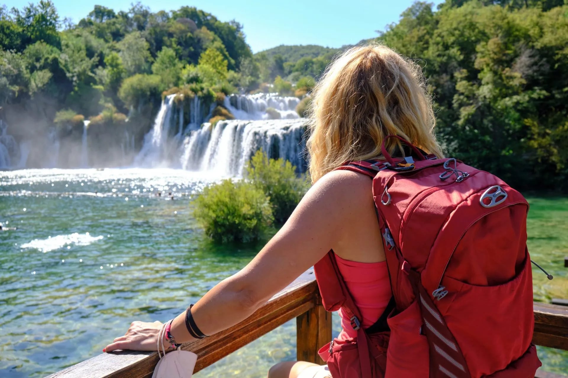
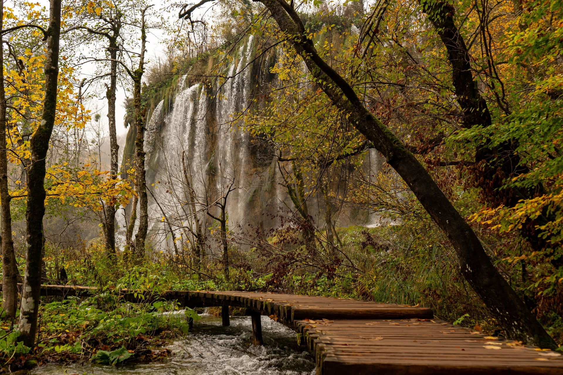
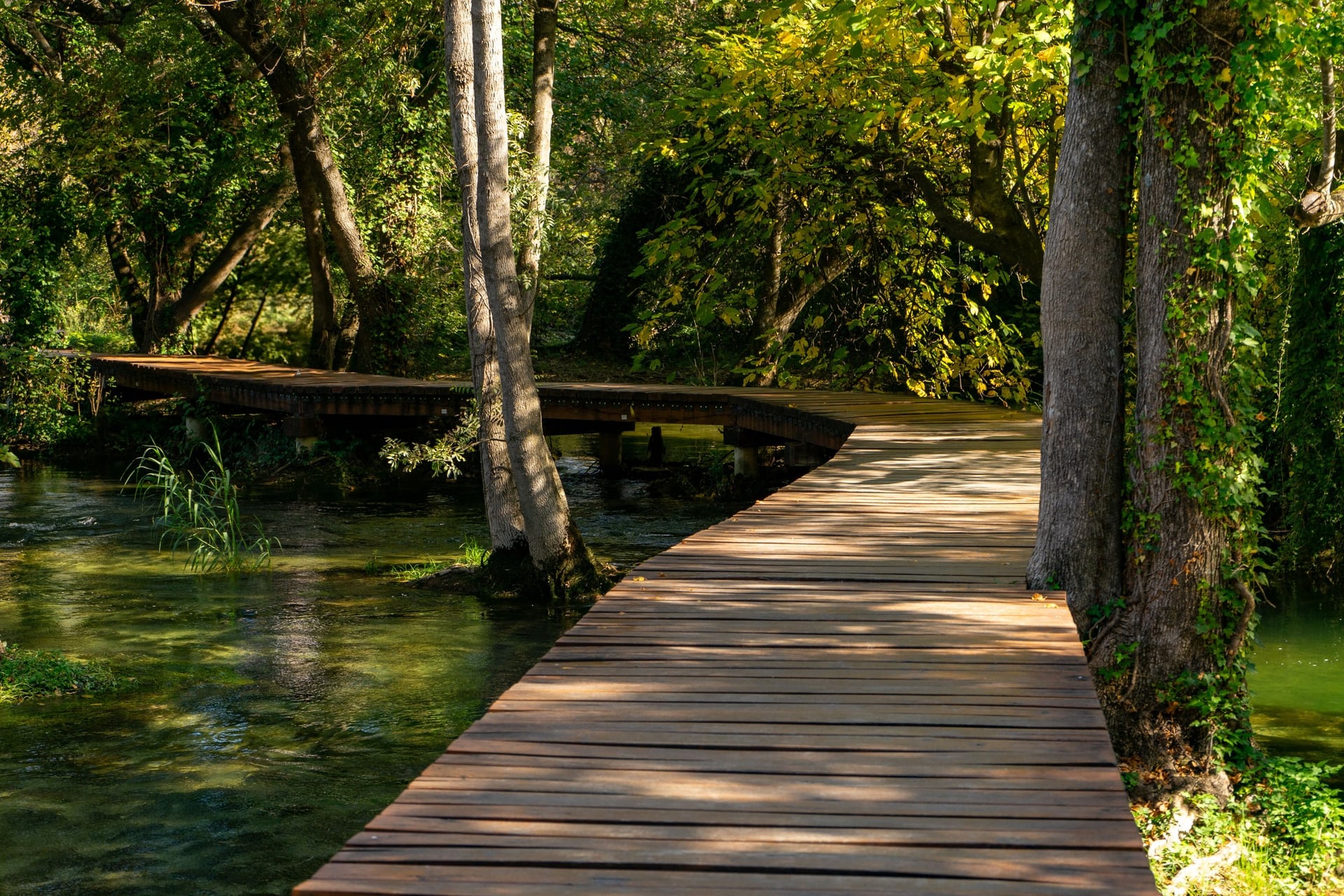
Walking in Croatia means pale limestone underfoot and water in view for most of the day. On the coast the path runs above the Adriatic, on the islands it crosses from one harbour to the next, and at Plitvice it threads boardwalks between lakes.
These twelve day walks run from Istria in the north-west to Dubrovnik in the south. Most are 2 to 12 km long and start from a town, a bus stop or a ferry landing. This is walking rather than climbing: the highest point is Vojak, 1,401 m, reached from a road pass at 922 m.
Spring and early autumn suit every walk on the list, and in July and August the coast and islands are best walked early.
The 12 Best Walks in Croatia
The twelve walks run from north-west to south-east, so the numbers follow the map from the Parenzana railway in Istria to Mount Srđ above Dubrovnik.
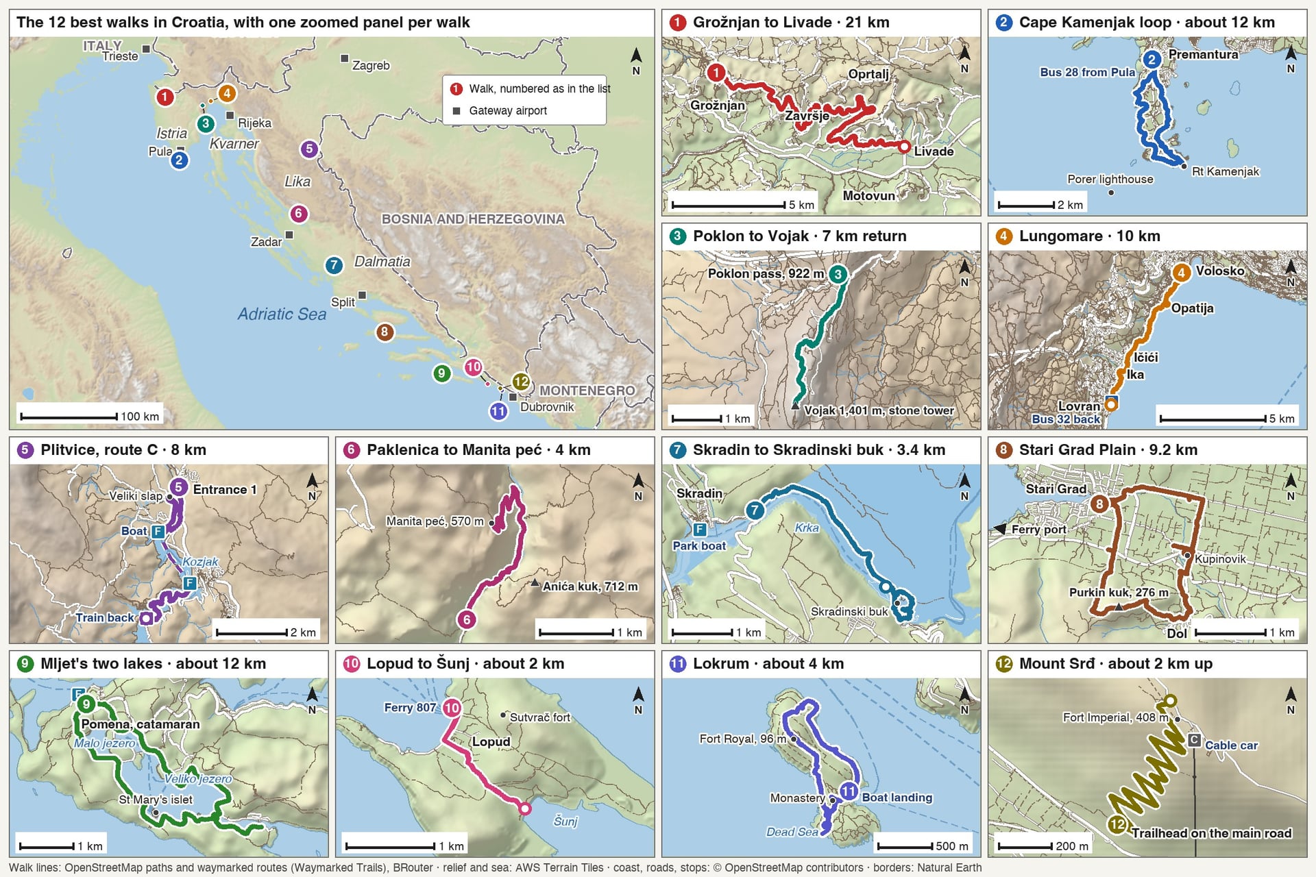
Distances and climbs come from the park or tourist board in charge of each walk. Where none publishes a figure, it was measured on the OpenStreetMap paths and is given as "about".
Walk | Distance | Elevation gain | Highest point | Start |
Parenzana, Grožnjan to Livade | 21 km one way | Almost none, 280 m down | 293 m | Grožnjan old station |
Cape Kamenjak | About 12 km loop | About 120 m | About 45 m | Premantura |
Učka, Poklon to Vojak | 7 km return | 451 m | 1,401 m | Poklon pass |
Lungomare, Volosko to Lovran | 10 km one way | Almost none | About 20 m | Volosko |
Plitvice Lakes, Programme C | 8 km | About 140 m | About 640 m | Entrance 1 |
Velika Paklenica to Manita peć | 4 km one way | 450 m | 570 m | Velika Paklenica car park |
Krka, Skradin Bridge to Skradinski buk | 3.4 km, plus a 1.9 km loop | Small | About 60 m | Skradin Bridge |
Stari Grad Plain and Purkin kuk | 9.2 km loop | About 280 m | 276 m | Stari Grad |
Mljet, round the two lakes | About 12 km loop | About 150 m | About 40 m | Pomena |
Lopud, village to Šunj | About 2 km each way | About 60 m | About 60 m | Lopud harbour |
Lokrum | About 4 km loop | About 110 m | 96 m | Lokrum boat landing |
Mount Srđ | About 2 km one way | About 250 m | 408 m | Main road above Dubrovnik |
Choose by the day you have in mind:
A full day on easy ground: the Parenzana, 21 km on a railway grade from Grožnjan down to Livade
A summit without a mountain day: Vojak on Učka, 451 m of climbing from a pass at 922 m
No car at all: the Lungomare and Kamenjak by local bus, or Lopud, Lokrum and Mljet by boat
Two walks in one day: Lokrum, 4 km, in the morning and Srđ, 2 km up, in the evening
Walks 1 to 4 are in Istria and Kvarner, the bay between the Istrian peninsula and the mainland.
1. Parenzana Railway Path: Grožnjan to Livade
Start: Grožnjan's old station in the hamlet of Stanica, reached by taxi or one of the trail's listed shuttle firms in Buje
Distance: 21 km one way
Elevation gain: almost none, with 280 m of descent to 13 m at Livade
Highest point: 293 m, at the Kalcini tunnel just past the old station
Terrain: gravel railway bed with yellow signposts, lit tunnels and four viaducts up to 30 m high
Entry: free
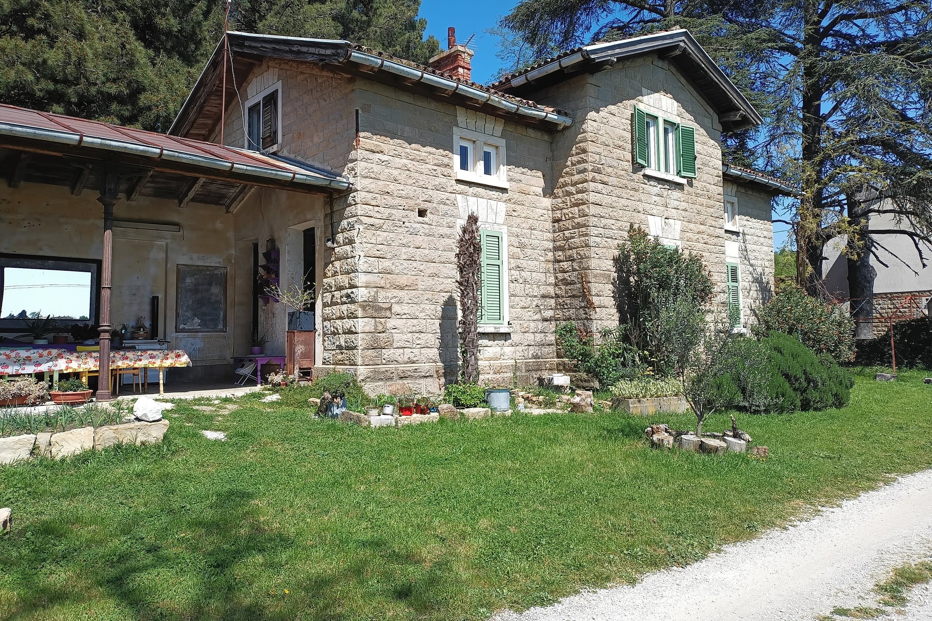
The Parenzana was a narrow-gauge railway that ran 123 km from Trieste to Poreč. It opened in 1902, and the last train ran on 31 August 1935. Its bed is now a path for walkers and mountain bikers, signed in yellow along the Croatian section.
From Grožnjan the line keeps its gentle railway grade along the side of the Mirna valley, past Završje and Oprtalj, so the walking stays easy for all 21 km. Four viaducts carry it over side valleys, the highest, at Freski, 30 m up. Livade's station, the only one fully preserved, holds a small Parenzana museum.
Motovun's old town looks down on Livade from its hill at 277 m, 264 m above the finish. Arriva's buses between Motovun and Pazin run on weekdays, so arrange the return before you set off.
2. Cape Kamenjak Loop From Premantura
Start: Premantura, 25 to 55 minutes from Pula on Pulapromet bus 28, depending on the route
Distance: about 12 km loop
Elevation gain: about 120 m
Highest point: about 45 m
Terrain: gravel tracks and rock shelves through garrigue, maquis and Aleppo pine
Entry: free on foot; cars pay from mid-June to September
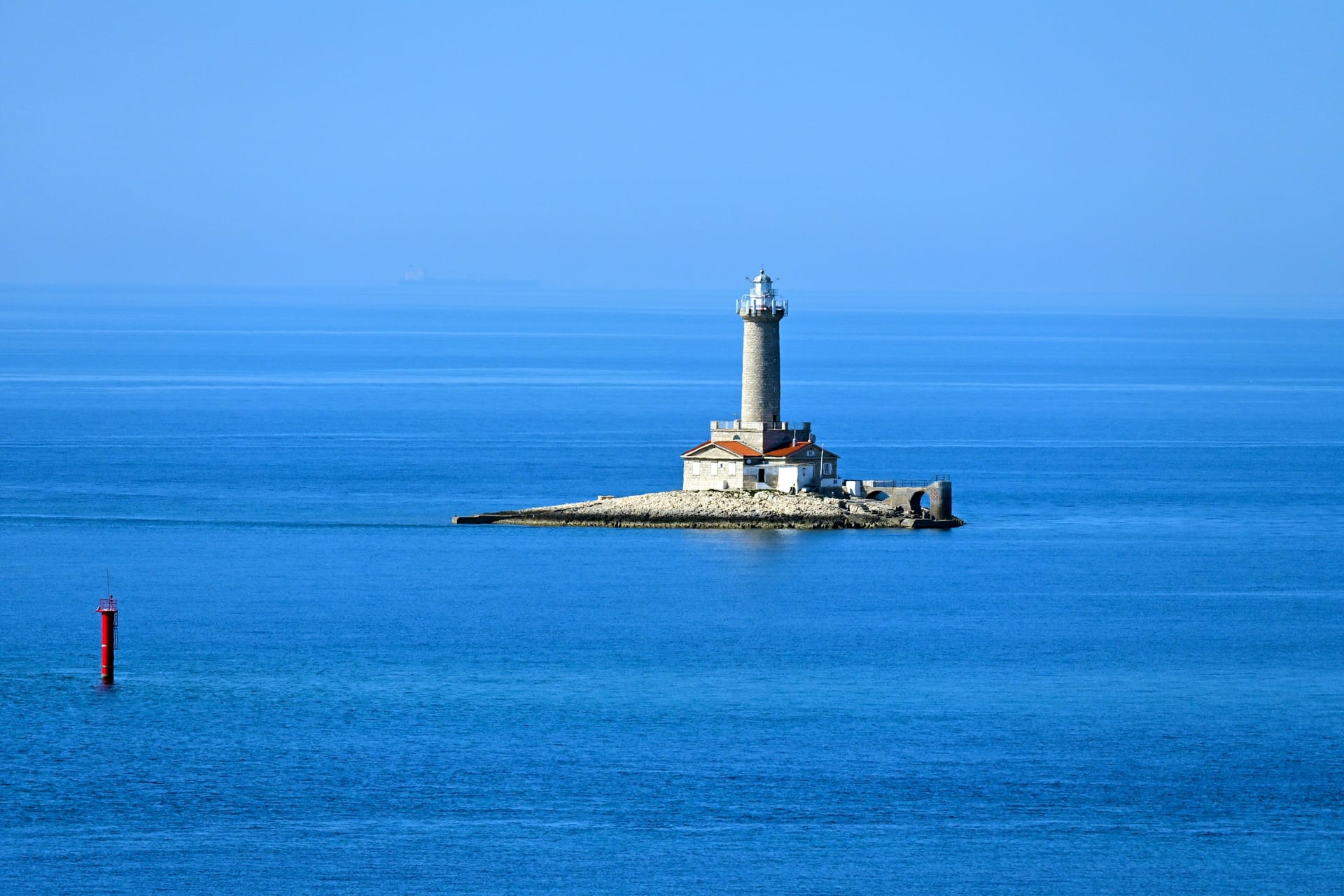
Kamenjak is the last 9.5 km of Istria, a protected landscape since 1996 with 30 km of indented coast. About 30 orchid species grow among more than 600 plants, and the park's managers name late spring and early autumn as the best seasons.
The loop leaves Premantura down the east side, rounds Rt Kamenjak and returns along the west coast past the dinosaur footprints at Grakalovac. Porer lighthouse, built in 1833 with a 35 m tower, stands on its islet off the cape. At Mala Kolombarica the so-called jumping canyon is only 2 m deep, so do not jump from the rocks there.
3. Učka: Poklon Pass to Vojak
Start: Poklon pass, 922 m; Autotrolej bus 34 runs up from Opatija on Sundays and public holidays only
Distance: 7 km there and back
Elevation gain: 451 m
Highest point: 1,401 m, on Vojak
Terrain: forest path through beech woods, then the stony summit ridge
Entry: free
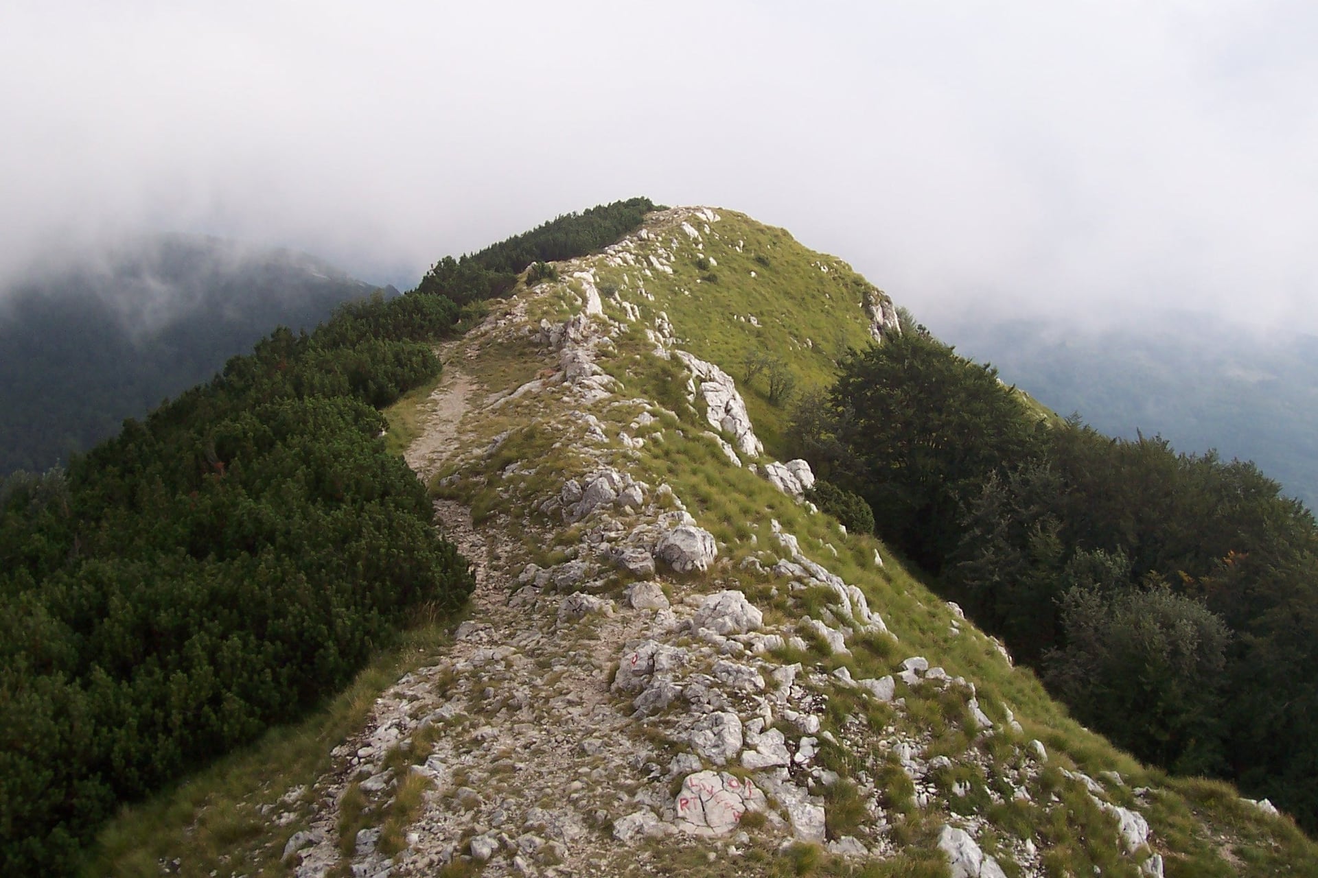
Vojak is the highest point of Učka Nature Park and of the whole Istrian peninsula. A stone tower built in 1911 stands on the summit, and from its deck, the park says, you see the Kvarner Bay with its islands, Velebit, the Alps and Italy.
The path climbs 451 m from the visitor centre at Poklon, and the parks portal allows about 1 hour 30 for the ascent. The Sunday bus gives a full day on the mountain: it leaves Opatija at 9:40, reaches Učka at 10:30 and starts back at 18:00. The park recommends the path all year except in deep snow.
4. Lungomare: Volosko to Lovran
Start: Volosko, on Autotrolej bus 32 from Rijeka, 20 minutes from Lovran
Distance: 10 km one way
Elevation gain: almost none
Highest point: about 20 m above the sea
Terrain: a seafront promenade, shaded in places by laurel and holm oak
Entry: free
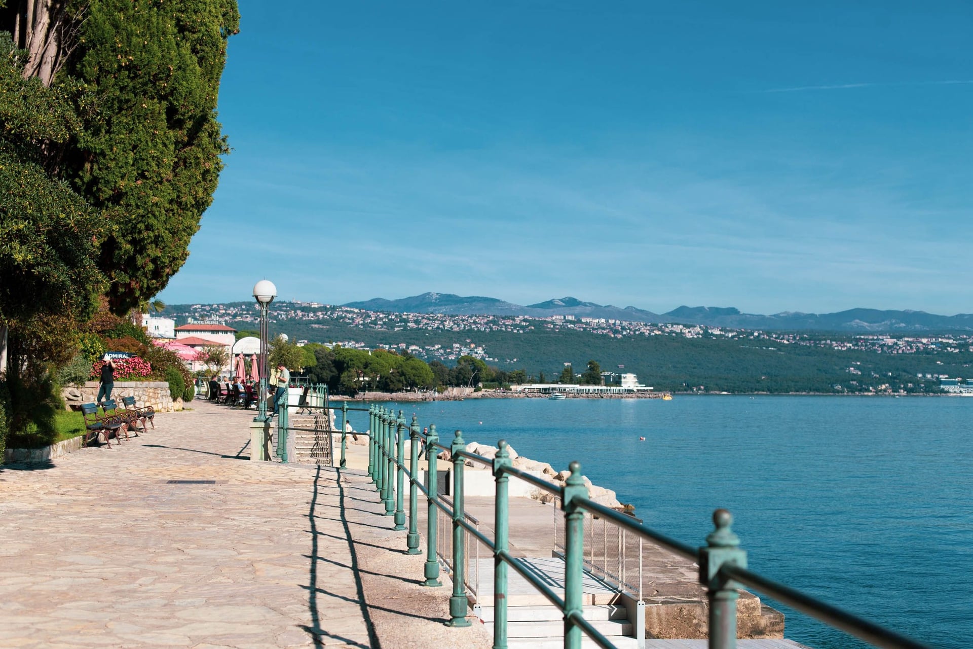
The Lungomare, officially the Franz Joseph I Promenade, follows the shore of the Opatija Riviera for 10 km, the Opatija tourist board says. On the way it passes Opatija, Ičići and Ika, with beaches from Slatina in Opatija to Peharovo in Lovran.
Opatija was declared an imperial climatic health resort in 1889, and its Hotel Kvarner of 1884 is called the first hotel on the Adriatic coast. Bus 32 makes this an easy one-way walk, with about 30 buses a day on weekdays.
Walks 5 to 7 are in three national parks on the way from Zagreb to Split.
5. Plitvice Lakes: Programme C From Entrance 1
Start: Entrance 1, with bus stops beside it; buses from Zagreb take 1 hour 50 to 2 hours 37
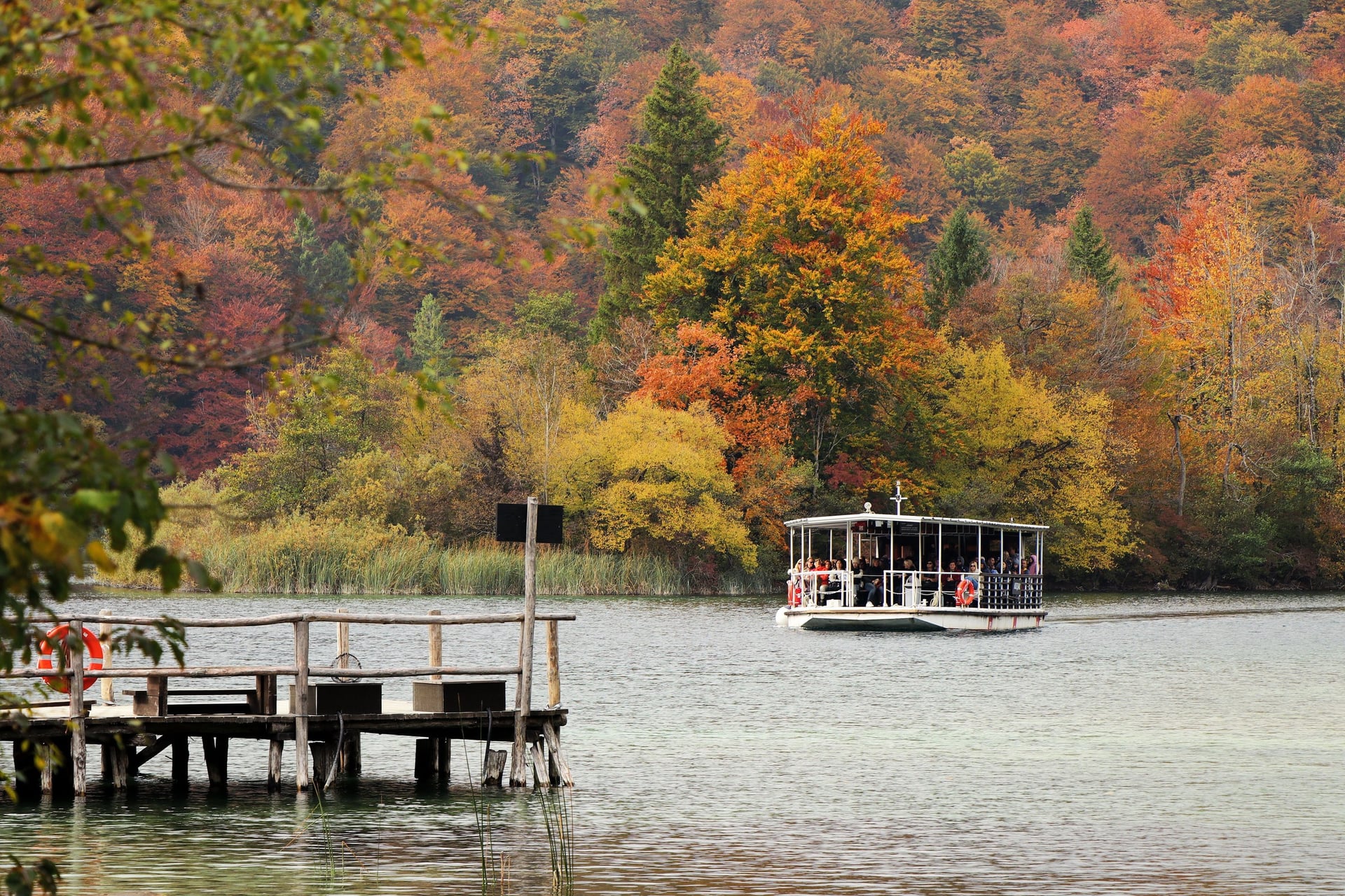
Distance: 8 km, with the electric boat across Kozjak and the panoramic train back
Elevation gain: about 140 m
Highest point: about 640 m, at the Upper Lakes
Terrain: wooden boardwalks and gravel paths beside the lakes, 4 to 5 hours in all
Entry: timed park ticket, with the boat and train included
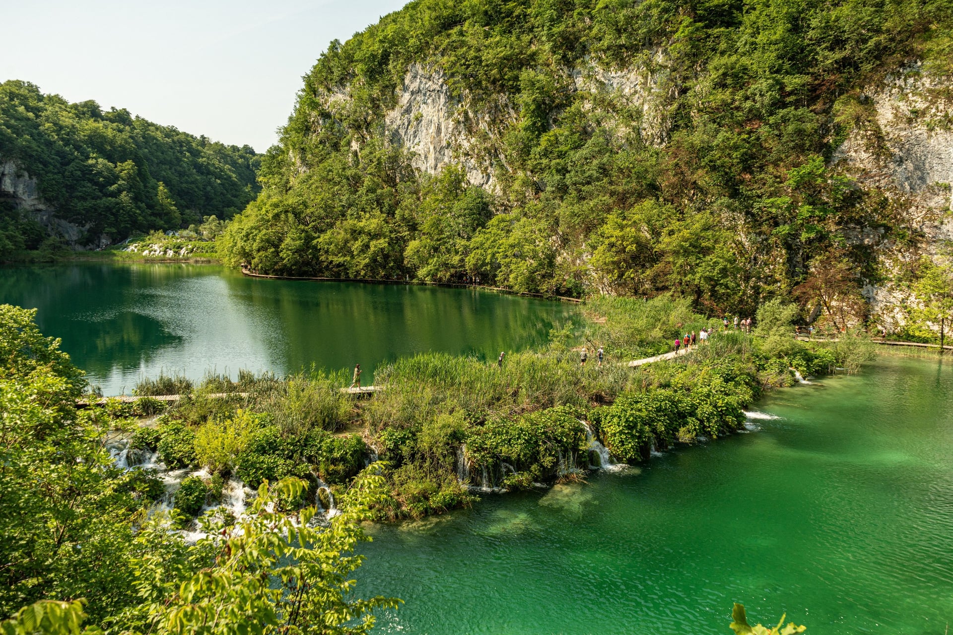
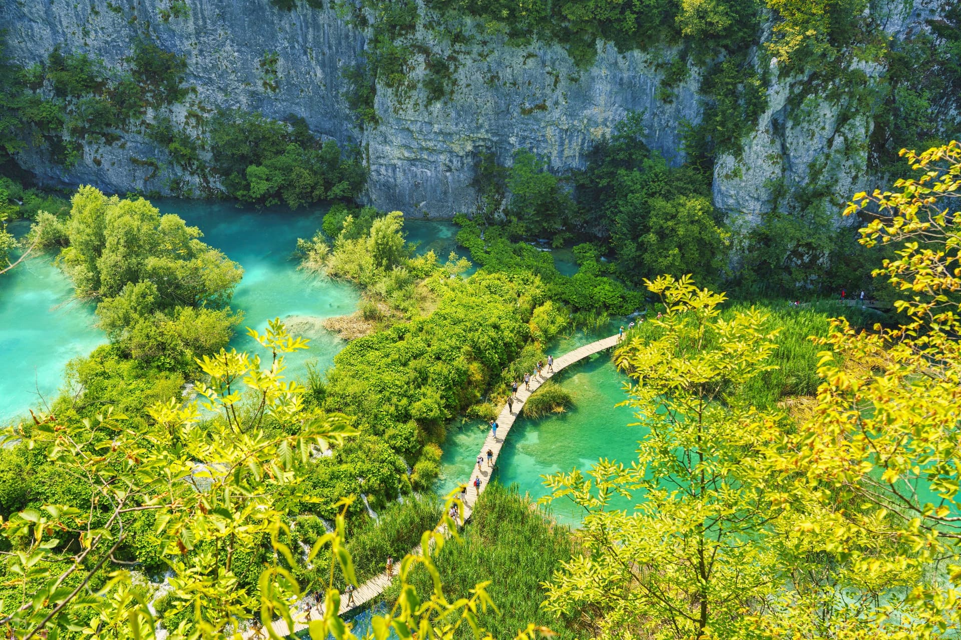
Sixteen named lakes step down the Plitvice valley, twelve Upper Lakes on dolomite and four Lower Lakes in a limestone canyon. The top lake lies at 636.6 m and the last at 503 m. Of Croatia's eight national parks, Plitvice is the oldest, declared a park in 1949.
Programme C starts with the Lower Lakes and Veliki slap, Croatia's highest waterfall, then crosses Kozjak by boat to the Upper Lakes. Tickets are timed, and you cannot enter early, though up to 1 hour late is accepted.
About 61% of visitors start at Entrance 1, so Programme H from Entrance 2, 8.9 km in 4 to 6 hours, starts with fewer people around you.
6. Paklenica: Velika Paklenica Canyon to Manita Peć
Start: the Velika Paklenica car park above Starigrad-Paklenica; buses from Zadar take about 45 minutes
Distance: 4 km one way
Elevation gain: 450 m
Highest point: 570 m, at the cave
Terrain: rocky canyon path, then 45 minutes of steady climbing with no water on the way
Entry: park ticket, plus a cash-only ticket for the cave
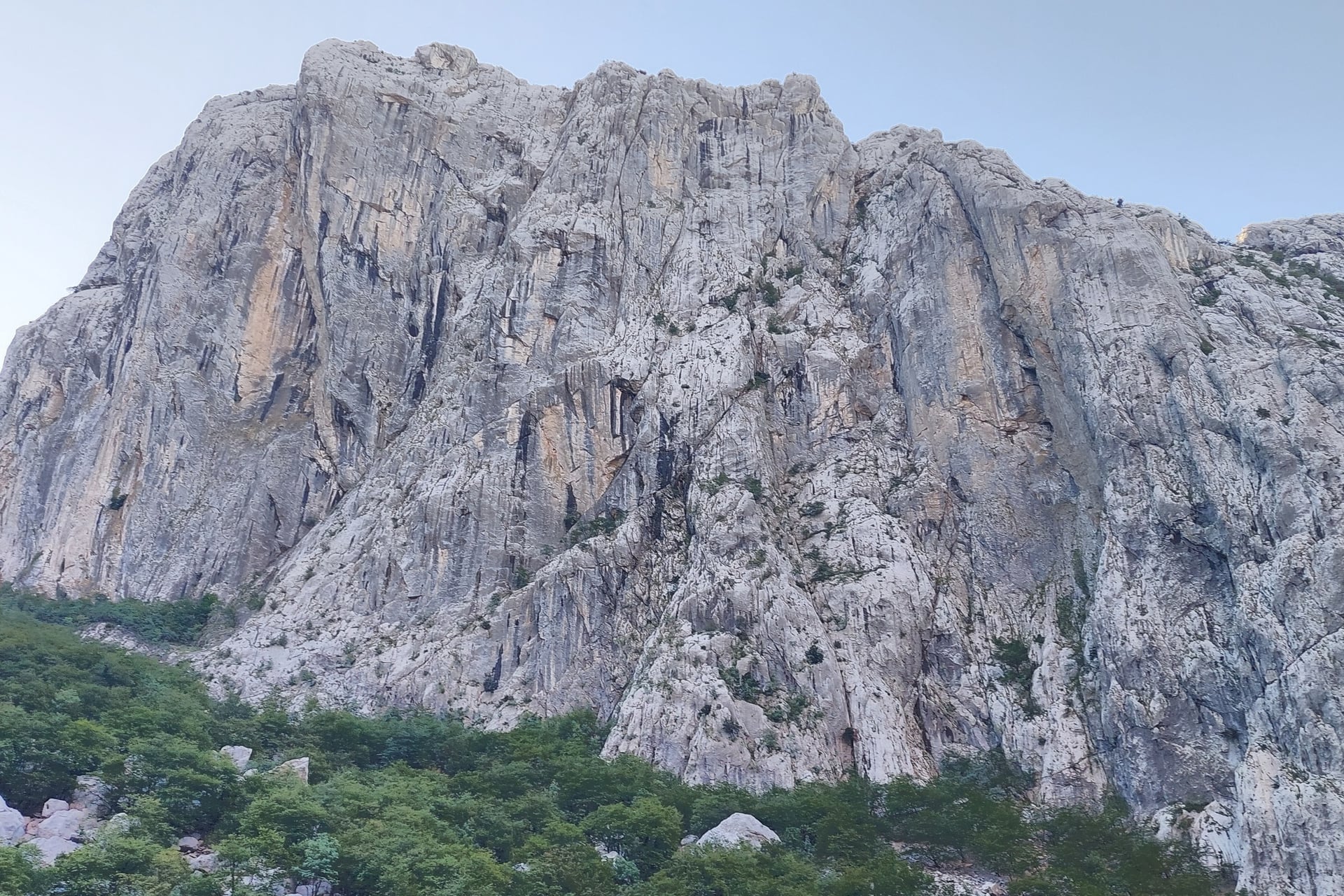
Velika Paklenica cuts into Velebit just behind the coast, through a canyon about 3 km long with walls up to 400 m high. Anića kuk, 712 m, is the great wall above the path, with climbing routes up to 350 m long.
The path reaches Anića luka in 20 minutes, and the cave path turns off 10 minutes later. The cave opens only from 10:00 to 13:00, on Saturdays in April, three days a week in May, June and October and daily from July to September.
Inside, Manita peć stays at about 9 °C all year. The mountain hut 6 km up the canyon, at 480 m, is the turning point for a longer day in Paklenica National Park.
7. Krka: Skradin Bridge to Skradinski Buk
Start: the park reception at Skradin Bridge, 10 to 20 minutes' walk from Skradin; buses run to Skradin from Šibenik
Distance: 3.4 km one way, plus the 1.9 km loop round the falls
Elevation gain: small; the trail starts with a long, gentle descent to the river
Highest point: about 60 m
Terrain: gravel and earth trail shared with cyclists, then a one-way boardwalk loop
Entry: park ticket, with the boat back to Skradin included from April to October
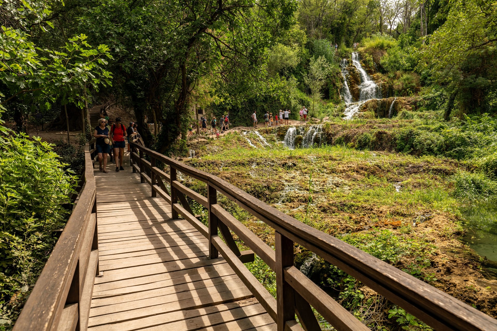
Skradinski buk is the last of the Krka's seven waterfalls and, the park says, the longest tufa barrier in Europe: 17 steps over 800 m of river, falling 45.7 m in all. The Skradin Bridge trail follows the right bank upstream to the falls.
The park does not allow swimming at Skradinski buk itself, and permits it only at marked spots at Roški slap, Stinice and Pisak from 1 June to 30 September. A ticket allows one visit to each site a day, so you cannot arrive by the Lozovac bus and leave on the Skradin boat.
Walks 8 to 12 are on the Dalmatian islands and around Dubrovnik, all reached by boat except Srđ.
8. Hvar: Stari Grad Plain and Purkin Kuk
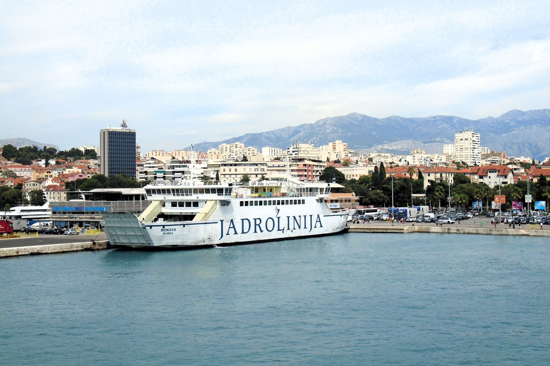
Start: Stari Grad; Jadrolinija car ferries from Split take 110 minutes and dock about 2 km west of the town
Distance: 9.2 km loop
Elevation gain: about 280 m
Highest point: 276 m, on Purkin kuk
Terrain: field tracks across the plain, then a path over Purkin kuk
Entry: free
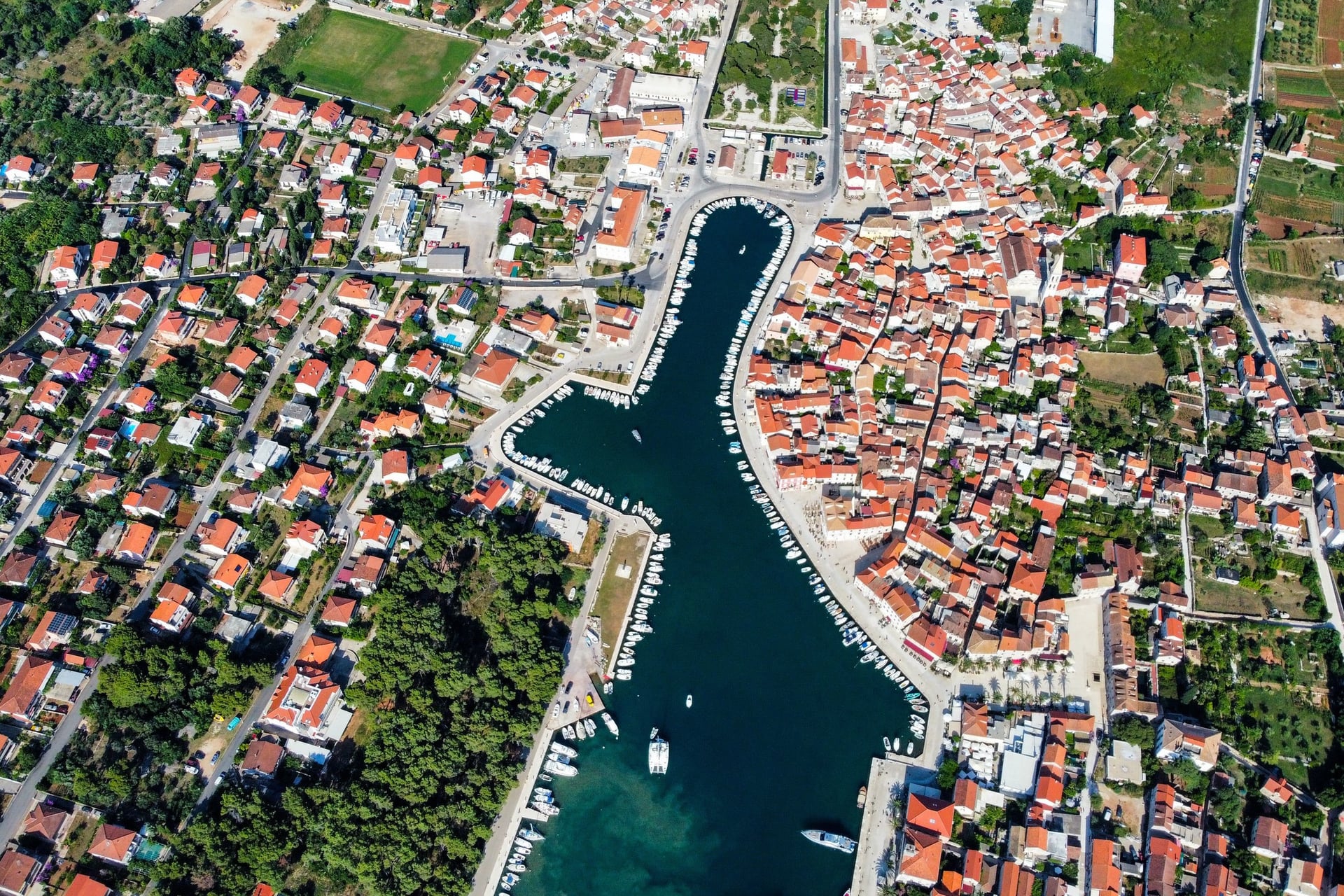
Greek settlers from Paros founded Pharos, today's Stari Grad, in 384 BC and divided the plain behind it into plots of about 180 by 900 m. They built its plots, terraces and roads with dry-stone walls, for grapes, wheat and olives.
UNESCO listed the Stari Grad Plain in 2008, and its dossier calls it the best-preserved ancient land division in the Mediterranean. The tourist board's Purkin kuk trail crosses the plain past the archaeological site of Kupinovik, then climbs to the hill south of the town. A shorter trail of 7 km leads to the stone cross on Glavica, 111 m.
9. Mljet: Around the Two Salt Lakes
Start: Pomena, 75 minutes from Dubrovnik on the Krilo catamaran, which runs from 12 May to 15 October
Distance: about 12 km loop
Elevation gain: about 150 m
Highest point: about 40 m
Terrain: lakeside paths and the flat lane round Veliko jezero
Entry: park ticket, with one return boat to St Mary's islet
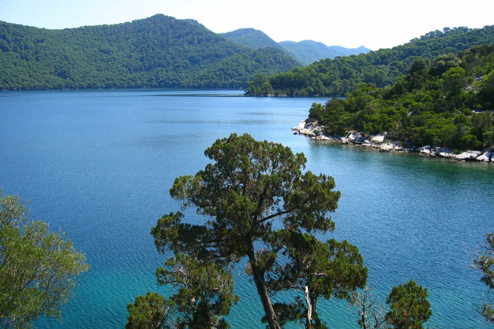
Mljet's two lakes are salt lakes joined to the open sea: Veliko jezero covers 145 ha and reaches 47 m deep, and Malo jezero covers 24 ha. A Benedictine monastery built between 1177 and 1198 stands on St Mary's islet in the larger lake.
The loop starts in Pomena, crosses to Malo jezero and follows both shores to the bridge at Soline. The park's boats leave Mali most and Pristanište every hour for the islet. A day trip on the Krilo leaves under 5 hours on Mljet, so stay a night in Pomena for the full loop.
Mali most is the park's recommended swim for children, and Malo jezero reaches 26 to 29 °C in summer.
10. Lopud: Village to Šunj Bay
Start: Lopud harbour, 45 minutes from Dubrovnik's Gruž port on Jadrolinija line 807, 55 minutes out of season
Distance: about 2 km each way
Elevation gain: about 60 m each way
Highest point: about 60 m
Terrain: a lane and path across the middle of the island
Entry: free
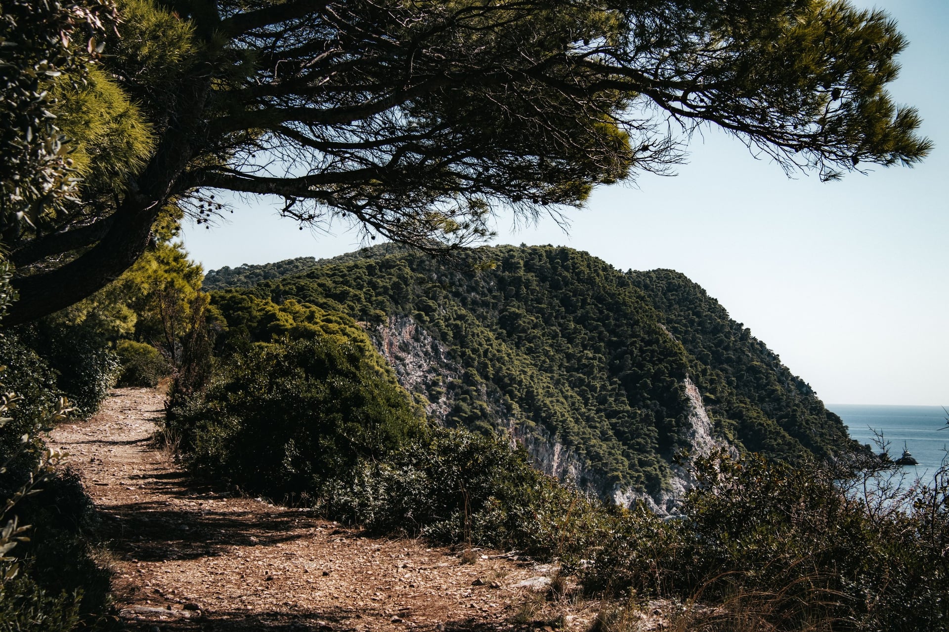
Lopud is one of only three inhabited islands among the 13 Elafiti, with 278 people at the 2021 census. Its village curves round a harbour with a Franciscan monastery, and Šunj, the island's sandy bay, lies on the far side, about 30 minutes away on foot, the Dubrovnik tourist board says.
Sutvrač fort stands on the hill above the village, at about 150 m. The same 807 boat continues to Suđurađ on Šipan, 15 to 20 minutes further on, where a lane leads across the island to Šipanska Luka.
11. Lokrum Island Paths
Start: Dubrovnik's old port; boats leave about every 30 minutes, and the tourist board puts the crossing at 10 minutes
Distance: about 4 km loop
Elevation gain: about 110 m
Highest point: 96 m, at Fort Royal
Terrain: marked paths through the forest that covers about 90% of the island
Entry: reserve ticket, with the return boat included
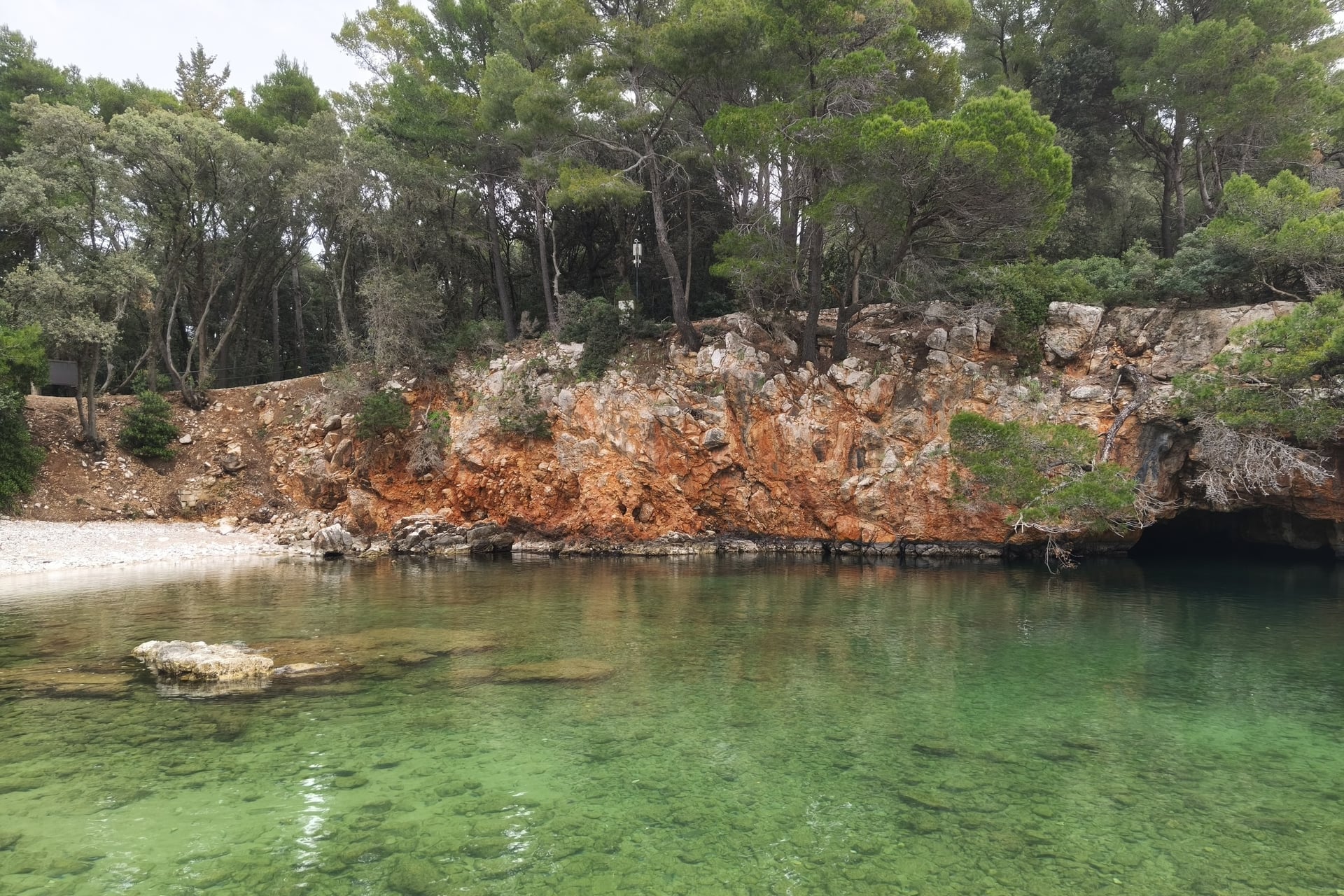
Lokrum is a forest reserve of 72 ha off Dubrovnik's old town, protected since 1948. Benedictine monks had arrived by 1023, and the botanical garden of 1959 is the only island botanical garden in Croatia.
An avenue from Maximilian's time climbs from the lower island to Fort Royal, begun by the French in 1806 and finished by Austria in 1835. The Dead Sea, a cave whose roof collapsed, joins the open sea through a 15 m channel.
Walking off the marked paths is banned, and nobody may stay after the last boat, at 18:00 in autumn.
12. Mount Srđ by the Way of the Cross
Start: the trailhead on the main road above the old town
Distance: about 2 km one way
Elevation gain: about 250 m
Highest point: 408 m, at Fort Imperial
Terrain: a rocky zigzag path through low scrub
Entry: free; the cable car down is extra
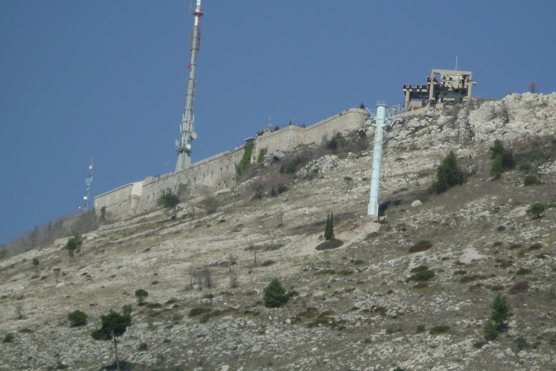
Srđ rises straight behind Dubrovnik's walls, and Fort Imperial, completed by the French in 1812, stands on top. The war museum inside the fort calls the zigzag path from the main road the Way of the Cross, and it climbs the open southern slope through low scrub.
The cable car closes from December to March, and bus 17 from Bosanka, behind the fort, runs on working days, once on Saturdays and not on Sundays. In winter, plan to walk down as well as up. With Lokrum and Lopud, Srđ makes three of the best walks around Dubrovnik without a car.
How Hard Are the Walks?
Most of the walks are easy to moderate: the longest is 21 km on a railway grade, and the biggest climbs are the 450 m to Manita peć and the 451 m to Vojak.
Heat, Rock and Water
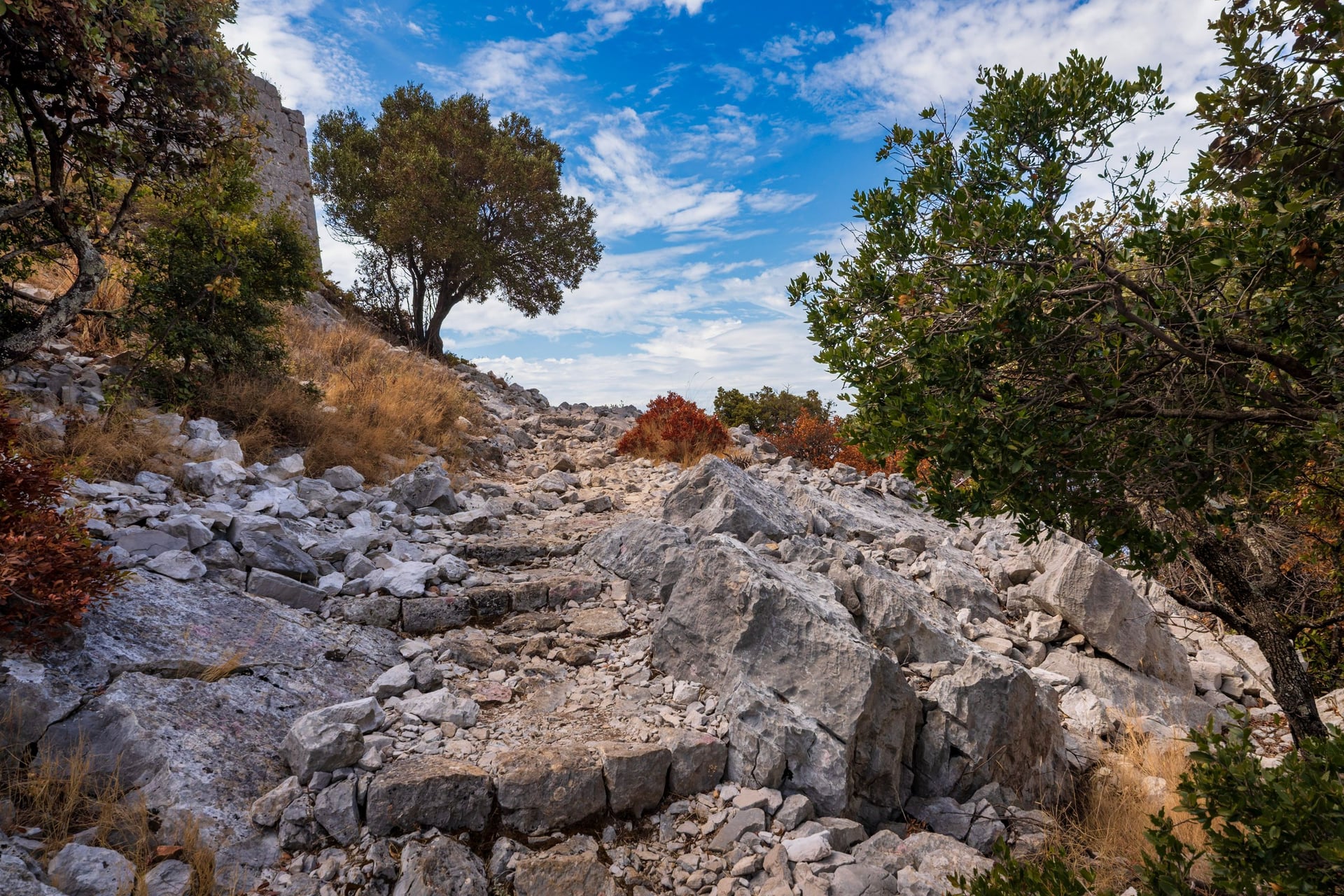
The ground almost everywhere is karst, limestone that rain has dissolved into bare slabs, sinkholes and caves, with thin soil and few springs along the paths. On the islands, paths such as those on Lopud climb over loose stone.
Heat is the real difficulty in high summer. In Split the temperature reaches 30 °C on about 16 days a month in July and August. Start early and carry water for the whole walk; the Paklenica park advises early starts on its exposed cave path, which has no water.
Outdoor fires are banned through the summer, with heavy fines, the UK Foreign Office says.
Waymarks and Park Rules
Hiking trails in Croatia carry the Croatian Mountaineering Association's waymark, a white circle inside a red ring. The Parenzana has yellow signposts, and Plitvice marks its routes green from Entrance 1 and orange from Entrance 2.
Park rules matter more than navigation. Swimming is banned in the Plitvice lakes and at Skradinski buk, and Lokrum forbids walking off its paths.
The Foreign Office warns of old minefields in remote parts of Plitvice and Zadar County, so stay on the marked paths in the parks and the hills. In an emergency call 112, which also reaches the mountain rescue service, HGSS.
Where the Mountains Start
Real mountain walking starts on Velebit, the long range behind the coast. Its Premužić Path, built in dry stone between 1930 and 1933, keeps a gentle grade for walkers new to mountains, and walking Velebit hut to hut on it takes three days.
The best hikes in Croatia for summit walkers are on Velebit and on Biokovo, where Sveti Jure rises 1,762 m above the Makarska Riviera. These are full mountain days rather than walks, and our sister brand covers them under hiking in Croatia.
When to Walk in Croatia
Spring and autumn are the walking seasons, when the coast is warm rather than hot, the parks run their full timetables and the island boats still sail.
Average daily highs come from the Croatian Meteorological and Hydrological Service (DHMZ), 1971 to 2000. Rovinj stands in for Istria and Gospić, in Lika, for Plitvice.
Months | Istria | Split | Dubrovnik | Lika | What changes |
April and May | 17 to 22 °C | 17 to 23 °C | 17 to 22 °C | 14 to 19 °C | Plitvice's Upper Lakes usually reopen; the Mljet catamaran starts on 12 May |
June | 25 °C | 27 °C | 25 °C | 23 °C | Summer tickets at Plitvice, Krka and Mljet from 1 June |
July and August | 29 °C | 30 °C | 28 to 29 °C | 25 °C | Split reaches 30 °C on about 16 days a month |
September | 25 °C | 25 °C | 25 °C | 21 °C | The sea off Split averages 22 °C |
October | 20 °C | 20 °C | 21 °C | 15 °C | Last Mljet catamaran on 15 October; Manita peć closes on 31 October |
November to March | 10 to 14 °C | 10 to 15 °C | 12 to 17 °C | 3 to 10 °C | The Dubrovnik cable car closes from December to March |
For most walks, May, June, September and October are the best months. July and August suit the islands and the Lungomare if you start early. October is the wettest month at Rijeka, so keep a spare day in Kvarner.
In winter the Upper Lakes at Plitvice usually close until early April, and Lokrum opened only at weekends in early 2026. Outside high summer the Elafiti boat sails only twice on Sundays.
Know Before You Arrive
Eleven of the twelve walks can be reached by bus or boat, but on the islands the timetable, not the path, sets the length of your day.
Getting There and Around Without a Car
Most UK flights to the Croatian coast run only in summer, so the airport you can reach decides which walks are a short transfer away.
By air:
Pula and Trieste, for walks 1 and 2: UK flights to Pula run in summer only, while Ryanair flies from Stansted to Trieste all year
Rijeka, for walks 3 and 4: Ryanair from Stansted in summer; the airport is on the island of Krk
Zagreb and Zadar, for walks 5 and 6: Zagreb has year-round flights from Heathrow and Stansted
Split, for walks 7 and 8: several UK airlines in summer, but none in the depth of winter
Dubrovnik, for walks 9 to 12: Ryanair flies from Stansted all winter, and United flies daily from Newark through the summer
From the USA: United is the only non-stop airline, to Dubrovnik and, three times a week, to Split
On the islands, boats do not sail in bad weather, so keep a spare half-day at the end of an island trip. Jadrolinija sells tickets online and in its app, and its line 807 to Lopud and Šipan sails four times a day from Monday to Saturday.
Croatia joined the Schengen area and the euro in 2023, and UK and US visitors may stay 90 days in any 180. The EU's Entry/Exit System now takes fingerprints and a photo at the border; the ETIAS travel authorisation has not started yet.
How Much It Costs
Seven of the twelve walks are free, and on the others the 2026 adult ticket usually includes the boat or train you need.
Plitvice Lakes: €10 in winter, €23 in spring and autumn, €40 in summer; €25 late on summer afternoons
Krka: €7, €20 or €40 by season, €30 after 3 pm in summer
Paklenica: €5, €8 or €10 by season, plus €5 in cash for Manita peć
Mljet: €20, or €30 in summer; a quarter less late in the day at the park's desks
Lokrum: €30, with the boat both ways
Cape Kamenjak: free on foot; €10 a day for a car in summer
Boats: Gruž to Lopud €3.40, or €5.40 in summer; Split to Stari Grad €5.90, or €8.40; Krilo to Mljet €25
Buses and cable car: local buses €2.50 to €4, the Srđ cable car €17 one way
Tourist tax: €1.33 to €2.65 a night from April to September, less in winter
What to Pack
Hot sun on bare limestone, swims and a cave at 9 °C set the kit for Croatia.
For any walk:
Trail shoes or light boots with a good grip
A sun hat, sunglasses and sun cream
A 20 to 25 litre day pack with a rain jacket
A phone with the route and a power bank
For Croatia:
Water for the whole walk, as the path to Manita peć has none
Swimwear and a towel for Kamenjak, the Lungomare, Mljet and Lopud
A warm layer for the cave at Paklenica
Euros in cash for the cave ticket
A passport or ID card, which TP Line checks on board
Long trousers or tick repellent for grassy paths in spring
One Region per Week: Which Walks Go Together
Croatia is long and narrow, with Grožnjan about 460 km from Dubrovnik as the crow flies, so a walking week works best in one region.
Walks 1 to 4 suit a week in Istria and Kvarner, walks 5 to 7 a road trip through the parks, and walks 9 to 12 a week in Dubrovnik with island days. The hard part is the planning: park entry slots, ferry times and moving bags between hotels.
Our self-guided weeks take care of that. We book 3-star hotels with breakfast and give you a digital guidebook, a GPS app and support while you walk.
The parks: our Croatia National Parks Walking Holiday is 7 days from Zagreb to Split, May to October, a self-drive trip to Plitvice, Paklenica, Krka and Biokovo with car hire on request
Dubrovnik and the islands: the Dubrovnik and Croatia Islands Walking Holiday is 7 days from Dubrovnik, April to September, with walks on Šipan and Mljet and luggage transfers
Istria: the Walk and Wine Istria Holiday is 7 days from Krasica to Lovran, all year, past Grožnjan and Livade to Motovun, over Učka from Poklon and along the Lungomare, with luggage moved
Ask us about dates for next season.
On the parks week the last walk starts at the hotel door in Makarska and climbs Biokovo to Vošac, where the view takes in the Adriatic and the islands.
Frequently Asked Questions



Plan with a hiking expert
Free advice from a team that knows these routes inside out - real people, not a bot

HASSLE-FREE
We handle itineraries, accommodations, and anything else you prefer not to deal with, so you can enjoy a carefree hike.

BOOK WITH CONFIDENCE
We are a financially protected company, fully bonded and insured, keeping your money safe and allowing you to travel with confidence.

TRIED & TESTED ADVENTURES
Only the best walking tours in Croatia, cherry-picked by our team with an in-depth knowledge of the region.

UNBEATABLE SUPPORT
Our 24/7 customer support is where we show our passion, bringing you a better experience by making your well-being our number one priority.